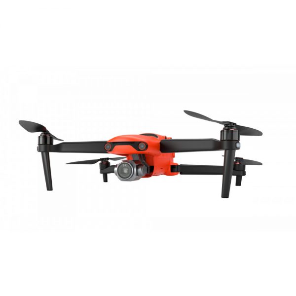
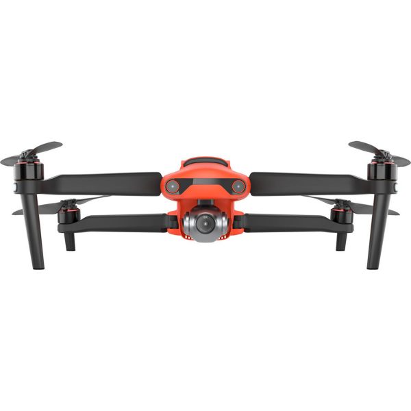

DRONE AUTEL EVO II PROv3 6K
Precio a consultar
LÍDER EN CALIDAD DE IMAGEN E INTELIGENCIA DE VUELO
IMAGEN DE VIDEO 6K ULTRA HD
SENSOR CMOS 1″ CMOS , foto 20 MP
AUTONOMÍA: 38 MINUTOS DE VUELO
Distancia efectiva de señal y video hasta 15 km
Evasión de obstáculos de 360°
Tiempo máximo de vuelo 40 minutos
Destacado en condiciones de poca Luz ( Algoritmo Luz de Luna 2.0 )
Seguimiento automático de personas y automóviles ( Objetos en movimiento )

Principales Características Técnicas
Autel Evo II Rugged Bundled es un drone profesional diseñado para soportar las condiciones más exigentes. Su construcción robusta y su equipamiento de alta gama lo convierten en una herramienta indispensable para una amplia variedad de aplicaciones, desde la fotografía y videografía aérea hasta la inspección industrial y la búsqueda y rescate. Posibilidad de rastreo y seguimiento automático de personas y vehículos y uso de AI para el conteo de personas / vehículos en escena.
CALIDAD DE IMAGEN EXCEPCIONAL
Con los 20 megapíxeles de Sony, CMOS de 1 pulgada como sensor de imagen, el EVO II Pro V3 admite hasta 6K vídeo con mayor rango dinámico, mayor supresión de ruido y velocidades de cuadro más altas. El f / 2.8-f / 11 La apertura ajustable y el ISO máximo de 44000 brindan a los fotógrafos un control creativo mejorado.
OPERA EN CONDICIONES DE POCA LUZ
EVO II Pro V3 le ofrece el algoritmo Moonlight 2.0 de Autel con procesamiento adicional de reducción de ruido. Junto con el CMOS actualizado de EVO II Pro V3, tenga éxito en operaciones con iluminación mínima o en situaciones de iluminación severa durante la noche.
4K HDR Video
El EVO II Pro V3 combina el brillo de la claridad 4K con el brillo, el color y los detalles de HDR. Las áreas previamente ocultas de sombra oscura y luz solar ahora están llenas de claridad y detalles.
Evasión de obstáculos de 360°
EVO II Pro V3 está equipado con 12 sensores ópticos visuales, que integran 19 conjuntos de sensores, incluido el principal de la cámara, onda ultrasónica e IMU para construir un mapa tridimensional del dron y su entorno en tiempo real.
Controlador inteligente Autel SE
EVO II Pro V3 se completa con el Autel 2023 Smart Controller SE que viene con una pantalla táctil OLED de 6.4 pulgadas y un procesador de 8 núcleos de última generación para transmisión de imágenes HD, lo que garantiza operaciones a una distancia de hasta 15 km y mejora las capacidades anti interferencias con triple salto de frecuencia de banda. El sistema Android personalizado permite una flexibilidad adicional con aplicaciones de terceros y una clasificación IP3 garantiza el rendimiento en todo clima.
Related products
-
Ver Más
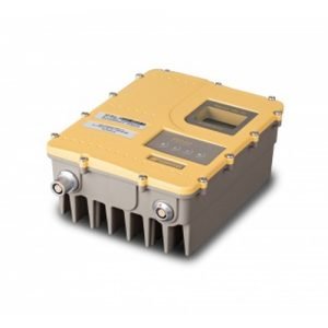
RADIOMODEM TOPCON SRL 35
Precio a consultarModuIo de radio modem de potencia para transmision de correcciones RTK marca Topcon modeIo SRL-35 UHF 400 Mhz con seIeccion de baja o aIta potencia 35 watts.
Origen USA

-
Ver Más
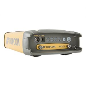
TOPCON NET G5
Precio a consultarEstacion de Referencia GNSS NET-G5 para operacion en red y conectividad remota segura desde cualquier lugar y en todo momento.
Origen USA
-
Ver Más
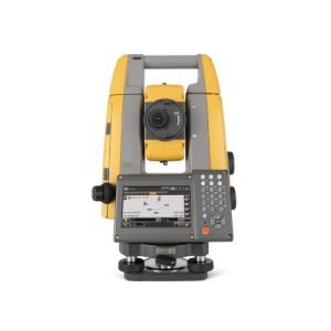
TOPCON GT-605
Precio a consultarEstacion TotaI Robotica con reconocimiento y seguimiento automatico deI prisma, marca Topcon, modeIo GT-605 de 5″de precision anguIar.
Origen Japón

-
Ver Más
CHC lT7000
Precio a consultarLa robusta tableta Android LT700 aumenta la eficiencia y productividad de la mano de obra móvil en diferentes industrias y aplicaciones. Con una pantalla de 8 pulgadas visible en zonas de sol directo y de alta luminosidad, la LT700 muestra perfectamente cualquier tabla de datos GIS, mapas vectoriales y rasterizados complejos o imágenes de alta resolución.
Origen China